Gonur Depe: The Lost City a Whole Civilization Forgot
A shard of pottery in the Karakum led to a 4,000-year-old capital with water pipes, gold-filled tombs and no remembered name. What happened to Gonur Depe?
A man stoops in the desert and picks up a piece of broken pottery. That small motion, in 1972, is about to resurrect a civilization the world had completely forgotten existed.
The man was a Soviet archaeologist named Viktor Sarianidi. The place was a low grey mound in the Karakum Desert of Turkmenistan, a hill the local Turkmen simply called "Gonur Depe" — "Grey Hill." Nobody thought much of it. Just sand, and a bump in the sand.
But under that bump lay an entire planned city, more than four thousand years old. It had palaces, temples, treasure-filled tombs, and water pipes. And then it had vanished so thoroughly that not even its name survived. Fifty years after the first excavations began, the site is still giving up new graves: a single spring season in 2024 uncovered 19 more burials (Turkmenistan.gov.tm). This is the story of what we actually know about Gonur Depe — and the genuine puzzles nobody has solved yet.
> The 60-Second Brief
> - 1972: Viktor Sarianidi finds pottery on a mound locals called "Grey Hill," about 60 kilometers north of the modern city of Mary in Turkmenistan.
> - The city covered roughly 55 hectares, and radiocarbon dating puts its life span at about 2400 to 1600 BCE.
> - At its center stood a mudbrick palace of roughly 150 by 140 meters, wrapped in double walls, with reservoirs fed through ceramic pipes.
> - The Murghab delta holds more than 150 ancient settlements, and Gonur appears to have been the capital of them all.
> - The Large Necropolis holds more than 3,000 burials across about 10 hectares. Burial 3200, from around 2250 BCE, held a horse beside a four-wheeled wagon.
> - 0 deciphered texts have been confirmed at the site after more than 50 years of digging, so nobody knows what its people called themselves.
What We Actually Know
Start with the map. Gonur Depe sits in the delta of the Murghab (Murgab) River, about 60 kilometers north of the modern city of Mary — the site of ancient Merv (Wikipedia; Silk Road Treasure Tours). From the early 1970s onward, the Margiana Archaeological Expedition dug into it under Sarianidi's direction. He kept at it for four decades, excavating almost until his death in 2013 (Vassar College).
And the deeper they dug, the bigger it got. This was not a village. It was a planned Bronze Age city sprawling across roughly 55 hectares, and radiocarbon dating pins its life span from about 2400 to 1600 BCE — built in waves conventionally grouped around 2300–1900, 1900–1700, and 1700–1500 BCE (Wikipedia). At its center sat a monumental mudbrick palace, roughly 150 by 140 meters, wrapped in double defensive walls. Around it: courtyards, temples, ritual areas, and water reservoirs fed through ceramic pipes (Wikipedia). People in the desert, four thousand years ago, were plumbing their city.
Here's the part that changes the scale of the whole thing. Gonur wasn't alone. The Murghab delta holds more than 150 documented ancient settlements, and Gonur seems to have been the capital of all of them — the principal seat of a country the ancient texts called "Margush," known to classical writers as Margiana (eurasia.travel; Eurasianet). It's the star site of a whole Bronze Age culture Sarianidi named back in the 1970s: the Bactria–Margiana Archaeological Complex, or BMAC (Grokipedia summary of Sarianidi's coinage; Wikipedia).
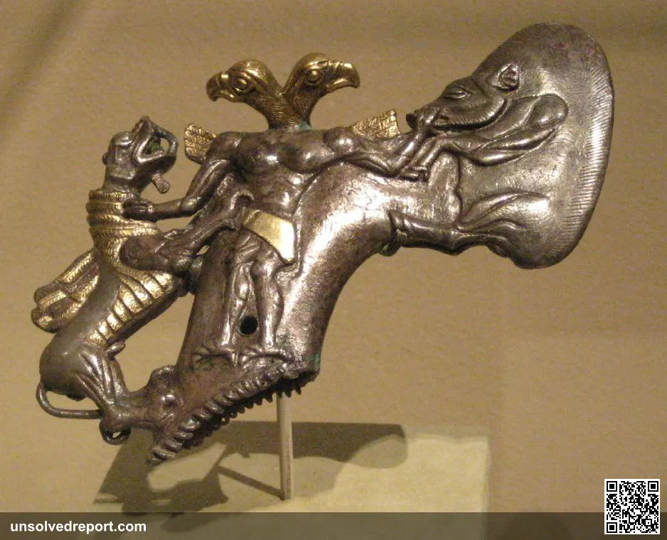
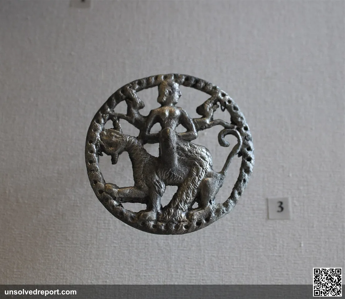
Then there are the graves, and the graves are something else. The Large Necropolis holds more than 3,000 burials spread across roughly 10 hectares, and a separate "Royal Necropolis" hid underground burial houses and pits packed with gold, silver, stone, and bronze (Wikipedia). One grave stops you cold — burial number 3200, dated to around 2250 BCE, holding a horse skeleton laid beside a four-wheeled wooden wagon with bronze-rimmed wheels (Wikipedia). The diggers also pulled out intricate mosaics that once decorated walls and wooden chests, bronze maceheads shaped like horses, objects carved from elephant ivory, carved stone statuettes, and a polychrome wall painting from a tomb — which Antiquity described as the first known polychrome painting ever found in BMAC territory (Cambridge Core / Antiquity).
Elephant ivory. In the desert. Which tells you these people were not isolated. Gonur's mosaics echo the styles of the royal cemeteries of Mari in Syria and Ur in Mesopotamia, and the goods buried here reflect contact with the Indus Valley — the same civilization that left behind puzzles like the Dancing Girl of Mohenjo-daro — as well as Iran and the inner Asian steppe (Vassar College; Wikipedia). Their own bodies tell the same story: ancient-DNA studies of BMAC individuals trace most of their ancestry to Iranian-plateau Neolithic farmers, with some people carrying South-Asian–related ancestry that fits contact with the Indus (Wikipedia). A trading crossroads, hiding under a grey hill — not unlike the fellow Bronze Age hoard at Tillya Tepe's Bactrian gold, buried in the same wider region.
So how does a thriving city like that simply disappear? Not in fire, and not in war — the best-documented answer is quieter and sadder than that. The Murghab River slowly wandered off course. As the water grew scarce, the people followed it, migrating tens of kilometers downstream over generations, drifting eventually toward the region that became Merv (visitworldheritage.com summary; turkmenportal.com). Sediment studies of the Murghab alluvium back this up: the channels shrank and wind-blown sand piled up during exactly the right period — an oasis drying out, one dry year at a time, beneath a city that was still very much alive.
Half a Century of Digging, and Still New Graves
The work Sarianidi started never stopped. 2024 marked 50 years since the first excavations at Gonur Depe began, and the Turkmen–Russian Margiana Archaeological Expedition, now led on the Russian side by Dr. Nadezhda Dubova, is still working the mounds (News Central Asia).
In April and May 2024, at a small settlement called Gonur-20, the team investigated 19 burials, 2 kilns and 9 other features, mostly pits in the ground. The finds included a miniature cylinder seal carved from talc-agalmatolite, a clay object bearing "snake" seal impressions, and sets of semi-precious stone beads from five graves, among them lapis lazuli beads whose diameter sometimes doesn't exceed 1 millimeter (Turkmenistan.gov.tm). The expedition has also identified five new settlements ringing Gonur within about 2 to 2.5 kilometers of the central complex. At one of them, Gonur-26, it found hand-formed pottery typical of pastoralist cultures and a remarkably well-preserved pottery kiln (News Central Asia). Five decades in, the grey hill still hasn't run out of surprises.
The Question Nobody Can Answer Yet
Here's the strange, frustrating heart of it. For all those walls and tombs and treasures, Gonur Depe cannot tell us its own story. No deciphered writing system has been confirmed at the site — a silence that echoes the still-unbroken Indus script next door — so nearly everything we know comes from objects and architecture, not from a single sentence the people themselves wrote down (Wikipedia). We don't securely know what language they spoke. We don't know how they pictured their gods. We don't even know what they called themselves.
And that silence opens the biggest question of all: who were they, really, and how do they fit? The BMAC sits at a four-way crossroads — between the Iranian plateau, the Indus Valley, Mesopotamia, and the Eurasian steppe — and scholars are still arguing about its exact place in the great population movements of the second millennium BCE, including the spread of Indo-Iranian languages and the meeting of settled oasis farmers with incoming steppe peoples (Wikipedia). Was Margiana just soaking up influences from its powerful neighbors? Was it an active hub that shaped them? Or was it a homeland for ideas that traveled far beyond the Karakum? The evidence is rich. It is also, so far, not conclusive.
The Theories — and How Much to Trust Them
"The fifth cradle of civilization" (Sarianidi's big claim). Sarianidi thought Margiana was so advanced it earned a seat at the table beside Egypt, Mesopotamia, India, and China — a fifth, independent birthplace of civilization (Eurasianet; UNESCO Russia commission). It's a bold framing, not a settled fact. Worth noting: the wider Murghab region is recognized internationally mainly through the "State Historical and Cultural Park 'Ancient Merv,'" added to the UNESCO World Heritage List in 1999.
The Zoroastrian-birthplace idea (genuinely disputed). This is Sarianidi's most famous claim. He read Gonur's fire altars and ritual rooms as a cradle of Zoroastrianism, and argued the temples were used to brew the sacred drink haoma (the Avestan cousin of the Vedic soma), pointing to plant residues he said included ephedra, poppy, and cannabis (Vassar College; Wikipedia). Other researchers pushed back hard. Some couldn't reproduce the narcotic-residue findings at all and identified the plant traces as ordinary food grains, and critics point out that early Zoroastrians aren't known to have built urban temples like these (Wikipedia). So treat the Zoroastrian connection as an intriguing hypothesis, not a proven one.
"The city the sands swallowed" (the popular legend). You'll often read that the desert simply ate Gonur whole, dramatic and sudden — the same fate popularly claimed for the Silk Road town of Niya, further east. The grounded version is less Hollywood and more human: a community calmly following its disappearing river downstream, over generations, instead of dying in one catastrophic night.
Whatever else it was, Gonur Depe is proof that the map of early civilization is still being sketched. A nondescript grey hill in the Karakum hid an entire forgotten world — and most of it is still down there, in the sand, waiting for the next person to bend down and pick something up.
Frequently Asked Questions
Where is Gonur Depe?
Gonur Depe is in the Karakum Desert of Turkmenistan, in the delta of the Murghab River. It lies about 60 kilometers north of the modern city of Mary, the site of ancient Merv (Wikipedia).
How old is Gonur Depe?
It is more than 4,000 years old. Radiocarbon dating puts the city's life span at about 2400 to 1600 BCE, with building phases conventionally grouped around 2300–1900, 1900–1700 and 1700–1500 BCE (Wikipedia).
Who discovered Gonur Depe?
The Soviet archaeologist Viktor Sarianidi identified the site in 1972. He led the Margiana Archaeological Expedition's excavations there for four decades, almost until his death in 2013 (Vassar College).
Why was Gonur Depe abandoned?
The best-documented answer is that the Murghab River slowly shifted course. As water grew scarce, the population moved tens of kilometers downstream over generations, eventually toward the region that became Merv. The city was not destroyed in a single disaster (turkmenportal.com).
Did the people of Gonur Depe have writing?
No deciphered writing system has been confirmed at the site. Almost everything known about its people comes from buildings and objects, so their language, their gods and even their name for themselves are still unknown (Wikipedia).
Was Gonur Depe the birthplace of Zoroastrianism?
That was Viktor Sarianidi's theory, and it is still disputed. He read the site's fire altars and ritual rooms as early Zoroastrian and said plant residues showed the sacred drink haoma was prepared there. Other researchers couldn't reproduce the narcotic-residue results, and critics note that early Zoroastrians aren't known to have built urban temples like these (Wikipedia).
Original Data: Gonur Depe's Size Next to Two Other Early Bronze Age Capitals
Sarianidi called Margiana a "fifth cradle of civilization" alongside Egypt, Mesopotamia, the Indus Valley, and China, but no single source puts Gonur Depe's footprint next to a city from one of those older, better-known cradles. The table below compiles the peak site area, population estimate, and occupation dates for Gonur Depe, Mohenjo-daro (Indus Valley), and Uruk (Mesopotamia) from their own Wikipedia entries, then calculates each site's population density and its size relative to Gonur.
| Site | Region / Culture | Peak Area | Est. Population | Occupation / Peak Dates | People per Hectare (our calculation) | Size vs. Gonur (our calculation) | First Excavated | Source |
|---|---|---|---|---|---|---|---|---|
| Gonur Depe | Bactria–Margiana (Turkmenistan) | 55 hectares | not published | 2400–1600 BCE | not calculable — no population figure published | 1× (baseline) | 1972 (first surface pottery found by Sarianidi) | Wikipedia, Gonur Depe |
| Mohenjo-daro | Indus Valley Civilization (Pakistan) | 300 hectares (covered area) | at least 40,000 | Built c. 2500 BC, abandoned c. 1700 BC | 133.3 people/ha (40,000 ÷ 300, our calculation) | 5.5× (300 ÷ 55, our calculation) | 1924–1925 (large-scale excavation led by Kashinath Dikshit; site identified by R.D. Banerji in 1919–1920) | Wikipedia, Mohenjo-daro |
| Uruk | Sumer (Mesopotamia, Iraq) | 250 hectares (by end of Uruk period, c. 3100 BC) | up to 50,000 (with 80,000–90,000 in its environs) | Peak c. 3100 BCE | 200 people/ha (50,000 ÷ 250, our calculation) | 4.5× (250 ÷ 55, our calculation) | 1850–1854 (excavations led by William Kennett Loftus, who first visited the site in 1849) | Wikipedia, Uruk |
Set against two cities from civilizations Sarianidi explicitly compared Margiana to, Gonur Depe is the smallest of the three by a wide margin — about a fifth the size of Mohenjo-daro and a bit over a fifth the size of Uruk at its Uruk-period peak. Neither Mohenjo-daro's nor Uruk's population figures can be applied to Gonur, though, because no source in this comparison publishes a population estimate for the site at all, so its likely population density is left an open question rather than a filled-in number.
How We Compiled This
- Sources. Wikipedia's articles on Gonur Depe, Mohenjo-daro, and Uruk — the same Gonur Depe article already cited throughout this piece, checked against the other two sites' own entries.
- Definitions. "Peak Area" is each site's own stated maximum extent (Mohenjo-daro's "covered area," Uruk's size "by the end of the Uruk period," and Gonur Depe's "total area"). "Est. Population" uses each source's own population estimate tied to that same peak period, where one is published.
- How calculated. People per hectare = estimated population ÷ peak area in hectares. Mohenjo-daro: 40,000 ÷ 300 = 133.3. Uruk: 50,000 ÷ 250 = 200. Size vs. Gonur = each site's area ÷ 55 hectares. Mohenjo-daro: 300 ÷ 55 = 5.5. Uruk: 250 ÷ 55 = 4.5. Gonur Depe has no published population figure, so its density could not be calculated.
- Limitations. These three sites peaked centuries apart (Uruk c. 3100 BCE, Mohenjo-daro c. 2500–1700 BCE, Gonur Depe 2400–1600 BCE) and are measured by different excavation teams using different methods, so the comparison shows relative scale, not sites at the same moment in time. Mohenjo-daro's area is also reported differently depending on the source — Wikipedia's own article notes a UNESCO figure of 240 hectares alongside the 300-hectare estimate used here — so that row carries some source-to-source variance the table doesn't resolve. Uruk's area more than doubled to 600 hectares by around 2800 BC, a later period not used in this table's comparison.
📌 Data status: verified 2026-09-29.
Sources and Further Reading
- Gonur Depe — Wikipedia
- "New polychrome painting from Gonur Depe, Turkmenistan" — Antiquity, Cambridge Core
- Gonur Depe — Central Asia Sites, Vassar College
- Turkmenistan: Making a Bid for Cradle-of-Civilization Status — Eurasianet
- Ancient Margiana a Center of Global Civilization — UNESCO Russia commission
- Gonur Depe — Bronze Age Capital of Ancient Margiana — Silk Road Treasure Tours
Taos Hum: The Sound Only 2% Can Hear—Machines Found Nothing
Only 2% of people near Taos, New Mexico can hear a strange low drone nobody else can — and government scientists never found where it comes from. Why?
Strangest Historical Events: 12 Real Moments Nobody Can Explain
A town danced itself to death. A crew vanished from a seaworthy ship. Twelve strangest historical events — all documented, all still argued over.
Giants of Mont'e Prama: The 3,000-Year Army Someone Smashed
A farmer's plow hit a stone head in Sardinia and uncovered a buried army of giants, all shattered. Nobody agrees who smashed them, or why. Here's what we know.